My Towns - United Kingdom
Welcome to our website of United Kingdom towns and villages, here you will find maps, weather, and histories of UK places.
Information Maps and Weather for UK Towns
My Towns - United Kingdom
Below and throughout this website you will find lots of information, maps and weather for leading UK towns, villages and cities, as time progresses it is also our intention to feature histories for the various towns. We shall also be featuring towns in countries all over the world and already have sections on Spain, Italy and Mexico. Below are links to the latest pages added to the website, we hope you will find something useful:
Royston Hertfordshire - Royston is one of those towns that quietly ticks all the boxes—small enough to feel personal, but big enough to keep you busy. It sits neatly in North Hertfordshire, not far from the Cambridgeshire border, and has a proper market town feel with a historic centre, traditional pubs, and a strong sense of local life. You've got a mix of commuters, families, and long-timers here, and it's the kind of place where people tend to stay once they've settled in. The town is well-kept, welcoming, and surrounded by miles of open countryside.
Maryport Cumbria - Maryport sits snugly on Cumbria's western coast, where the Solway Firth meets the Irish Sea. It's got proper seaside charm—harbour views, fishing boats, and a welcoming feel that mixes old-school maritime character with a surprisingly lively cultural scene. The streets are a blend of pastel-fronted houses, independent shops and cafes, with a backdrop of rugged coastline that gives the town its identity.
Cirencester Gloucestershire - Cirencester is one of those towns that somehow manages to feel both elegant and cosy at the same time. Nestled in the heart of the Cotswolds, it's often referred to as the capital of the region, and for good reason. The honey-coloured buildings, winding lanes and relaxed pace of life give it plenty of charm, while its bustling market square and range of independent shops keep things lively. It's a proper Cotswold gem with a proud local identity and a friendly, laid-back feel.
Kenilworth Warwickshire - Kenilworth is one of those places that seems to blend history, greenery and a strong sense of community into a really lovely balance. It's a proper Warwickshire market town with a bit of everything going for it—historic ruins, neat high streets, independent shops, and a good dose of countryside charm. Tucked between Warwick and Coventry, it's close to the action but far enough out to feel relaxed. You get the impression that life ticks along nicely here, with plenty to keep locals and visitors interested.
Ledbury Herefordshire - Ledbury is one of those places that catches your eye the moment you step off the train or stroll into the high street. It's got that timeless English charm, with black-and-white timbered buildings, a proper market house on stilts, and narrow alleyways full of independent shops and little cafés. Tucked into the east of Herefordshire, it's not far from the Malvern Hills, so the countryside always feels like it's just around the corner. The town has a laid-back, creative energy, and there's always something going on—whether it's poetry, art, music, or just a good natter in one of the pubs.
Bangor Northern Ireland - Bangor, perched on the edge of Belfast Lough, has that breezy seaside charm that makes it feel like you're on a bit of a break, even if you're just passing through. It's one of Northern Ireland's most relaxed and likeable spots, with a bustling marina, parks that open onto the sea, and a town centre that's got just enough going on without the full-on city pace. Whether you're sitting outside a café by the water or taking a wander along the coastal path, there's something refreshing about life in Bangor.
Richmond Greater London - Richmond-upon-Thames is one of those places that makes you forget you're still in London. Nestled along a particularly scenic stretch of the Thames, it's known for its green spaces, riverside pubs, and relaxed, village-like atmosphere. You've got history, culture, and a touch of luxury all rolled into one, with a town centre that's easy to stroll through and views that'll stop you in your tracks. It's the sort of spot where you can have a pint by the river, go deer spotting, and still be back in central London in half an hour.
Shepshed Leicestershire - Shepshed is a laid-back, well-connected town tucked just off the M1 in north-west Leicestershire. It's the sort of place where everything feels within reach—shops, schools, green spaces, and friendly faces. While it might not be shouting for attention, it quietly ticks all the boxes for a solid Midlands town with a sense of identity and local pride. It's close enough to Loughborough for big-name amenities, but far enough out to hold onto that villagey charm.
Rhyl Wales - Rhyl is a lively seaside town on the north coast of Wales, sitting right on the edge of the Irish Sea with a long, sandy beach that draws in day-trippers, families and locals looking for a bit of sea air. It's one of those places where you can grab fish and chips, feel the breeze off the promenade and watch the waves roll in—proper old-school seaside charm mixed with new regeneration and a community that's proud of where it's from. It's got that familiar buzz in summer, while the quieter months give it a more relaxed, coastal pace.
Ayr Scotland - Ayr is a classic Scottish seaside town with a laid-back charm and a proud history, sitting right on the Firth of Clyde. It's the sort of place where you can wander from the high street down to the beach in minutes, grab an ice cream, and watch the tide roll in. With its sandy shore, leafy parks, and connections to one of Scotland's most famous sons, it's got more going on than first meets the eye. There's a good mix of old and new, and while it's relaxed, there's plenty happening under the surface.
Holmfirth West Yorkshire - Holmfirth sits snugly in the Holme Valley, a charming West Yorkshire town known for its honey-stone cottages, narrow lanes and dramatic views. With its reputation thanks to the classic sitcom Last of the Summer Wine, it draws people in with a friendly vibe, bustling café culture and that countryside-at-the-doorstep feel. It isn't huge, but it's lively, with a place for everyone—from walkers to film buffs, locals to day-trippers.
Conisbrough South Yorkshire - Conisbrough is one of those towns that manages to feel both steeped in history and properly lived-in. Nestled between Doncaster and Rotherham, it's got a castle on the hill, a tight-knit community in the streets below, and all the makings of a classic South Yorkshire spot—honest, welcoming and just a bit rough round the edges in the best kind of way. It's the sort of place where you can grab a decent chippy tea, walk through centuries of heritage, and still get the bus home in under ten minutes.
Flamborough East Yorkshire - Flamborough is the sort of place that stays with you long after you've left. Perched on a dramatic headland on the East Yorkshire coast, it's known for its rugged cliffs, seabird colonies, and old-world charm. The village itself is a bit of a time capsule, with whitewashed cottages, cosy pubs, and a proper sense of coastal character. It's popular with walkers, birdwatchers, and folk who like their sea views raw and unspoilt, and while it gets its fair share of visitors in summer, it never loses its quiet, local feel.
Robin Hood's Bay North Yorkshire - Robin Hood's Bay is the kind of place that sneaks up on you, in the best possible way. Perched dramatically on the North Yorkshire coast, it's a village of winding lanes, steep alleys, and red-roofed cottages that seem to tumble down towards the sea. It's got that storybook charm, with its jumble of fishermen's homes, smugglers' tales, and views that stop you in your tracks. It's small but unforgettable, and there's nothing quite like wandering down to the beach with the sea breeze in your face and the sound of seagulls overhead.... read more here: Robin Hood's Bay.
Eccles Greater Manchester - Eccles is a down-to-earth town in the City of Salford, part of Greater Manchester, with a strong sense of identity and a proper mix of grit and community spirit. It's probably best known for the world-famous Eccles cake, but there's more to the place than flaky pastry and currants. With decent transport links, a compact town centre and its close-knit neighbourhoods, Eccles holds onto its heritage while gradually adapting to modern life.
Stourbridge West Midlands - Stourbridge sits comfortably on the edge of the Black Country, where the West Midlands starts blending into the Worcestershire countryside. It's one of those towns that feels like it's got a bit of everything — bustling high street, a proper market town vibe, strong local pride, and plenty of green space nearby. Stourbridge has always carried that slightly calmer pace compared to its bigger neighbours, with tree-lined streets, tidy suburbs, and lovely walks along the canals and rivers that wind through the area.
Broadway Worcestershire - Broadway sits right at the foot of the Cotswold escarpment, where Worcestershire and Gloucestershire quietly meet in a sweep of golden stone, rolling hills and winding lanes. It's the kind of village that looks like it's come straight off a postcard — wide high street, honey-coloured buildings, flowers tumbling from windowsills, and not a modern shopfront in sight. It draws visitors in droves, but never seems to lose its calm, polished charm. Whether you're here for a wander, a cream tea or a weekend away, Broadway has a way of making you slow down and breathe it all in.
Whitley Bay Tyne and Wear - Whitley Bay sits right on the edge of the North Sea, with sweeping beaches, a proper seaside feel and that classic mix of sand, sea and a bit of northern charm. It's the kind of place where locals and visitors happily mix, with plenty of coffee shops, fish and chip takeaways, arcades and independent stores tucked alongside long stretches of coastline. The town has had its ups and downs over the years, but it's seen a real revival recently, bringing back some of that old-fashioned seaside sparkle.
Ironbridge Shropshire - Ironbridge sits tucked away in the beautiful Severn Gorge, and while it might be small, it's packed full of history and charm. This little village is often called the birthplace of the Industrial Revolution, thanks to its world-famous iron bridge, which arches gracefully over the River Severn and has become a symbol of British ingenuity. Today, Ironbridge is a lovely mix of historic buildings, independent shops, cafés, museums and walking trails, all wrapped up in some of Shropshire's most scenic countryside.
Lichfield Staffordshire - Lichfield might be one of England's smaller cities, but what it lacks in size it more than makes up for in charm, character, and history. Sitting in the heart of Staffordshire, it's best known for its stunning cathedral, lovely parks, independent shops, and lively café culture. It's one of those places where you can stroll around at a relaxed pace, take in the architecture, stop for a coffee, and feel like you've stepped into a peaceful corner of the world that hasn't lost touch with its roots.
Newbiggin-by-the-Sea Northumberland - Newbiggin-by-the-Sea sits quietly on the Northumberland coast, tucked between the busier stretches of Blyth and Amble, with a proper old-fashioned seaside charm about it. The long sweeping bay, soft sandy beach and iconic sculpture sitting out at sea give the place its own laid-back character. While it's smaller than some of its neighbours, Newbiggin's got plenty to offer for a peaceful day out or as a lovely place to call home, with the sea never far from sight or sound.
Worksop Nottinghamshire - Worksop sits right on the northern edge of Nottinghamshire, tucked between rolling farmland, old collieries and the edge of Sherwood Forest. It's one of those towns that feels like a proper gateway between the Midlands and Yorkshire, with a bit of a mix of everything — market town charm, a bit of industry, and a steady pace of life. While it's not as well known as some other parts of the county, Worksop holds its own with a surprising amount to see and do nearby.
Peterlee County Durham - Peterlee is a town that sits on the east coast of County Durham, not far from the North Sea, surrounded by green countryside and just a short drive from both Durham and Sunderland. Built as a new town, Peterlee has its own unique feel, with wide open spaces, plenty of greenery and a strong sense of local community. It's not flashy, but it's got everything you need close by, and the nearby coastline adds a touch of natural beauty that gives the place a bit of breathing space.
Shanklin Isle of Wight - Shanklin is one of the Isle of Wight's classic seaside towns, sitting snugly on the island's southeast coast. It's the kind of place that effortlessly blends old-school charm with a bit of modern energy. Known for its long sandy beach, pretty esplanade, and thatched cottages in the Old Village, it draws a steady stream of holidaymakers who fancy a relaxed break by the sea. There's something comforting about the place – a slower pace, friendly faces, and views that never get old.
Morecambe Lancashire - Morecambe is a seaside town with real character, perched on the edge of Morecambe Bay in the northwest corner of Lancashire. It's got a laid-back charm, wide open views, and some of the best sunsets in the country. Known for its long promenade, classic British seaside vibe and ties to comedy legend Eric Morecambe, the town draws in visitors after a dose of nostalgia, fresh sea air and old-school coastal charm. It's the sort of place where time feels a little slower and the horizon stretches on for miles.
Matlock Derbyshire - Matlock is one of those places that manages to feel both lively and laid-back at the same time. Set against the dramatic backdrop of the Derwent Valley, it's a proper Derbyshire market town with Victorian charm and easy access to the stunning countryside of the Peak District. The River Derwent winds its way right through the centre, and with plenty of green spaces, independent shops, and classic stone buildings, it's got a character that draws in day-trippers and holidaymakers all year round.
Middlewich Cheshire - Middlewich is a busy little town in the heart of Cheshire, known for its canals, salt heritage, and strong community feel. It's not flashy, but it's got that proper sense of local pride and friendliness. With its location tucked neatly between larger towns like Crewe and Northwich, it's well-placed without feeling overshadowed. The town centre has everything you need, the canal paths are ideal for a peaceful wander, and there's a steady flow of community events and activities that keep things ticking over.
More Cheshire Places: Tarporley - Chester - Nantwich
Chalfont St Peter Buckinghamshire - Chalfont St Peter is a large, lively village in south Buckinghamshire, often described as the “Gateway to the Chilterns.” It blends rural charm with the feel of a bustling community, making it one of the most popular places to live in the area. Surrounded by countryside yet well-connected, it's a spot where traditional village life meets commuter convenience, with a strong sense of identity and plenty going on.
Whittlesey Cambridgeshire - Whittlesey is a traditional Fenland market town tucked between Peterborough and the Cambridgeshire fens, with a character all its own. It's the kind of place where life has a gentler pace, yet there's always something going on. From the narrow winding streets and historic buildings to the lively pubs and independent shops, it's a proper community hub with deep roots and a strong sense of local pride.
More Cambridgeshire Places: March - Soham
Pangbourne-on-Thames Berkshire - Pangbourne is a picture-perfect village tucked beside the River Thames in West Berkshire, and it's got that lovely mix of countryside calm and a bit of bustle that gives it real character. With its riverside setting, old-world charm and a decent high street full of independent shops, it's a firm favourite with walkers, boaters and those looking for a quieter pace without being too far from the action. The surrounding countryside is just as easy on the eye—rolling hills, woodland paths, and plenty of good spots for a lazy picnic or a pub lunch - Pangbourne Map.
More Berkshire Places: Crowthorne - Hungerford - Sandhurst
Windlesham Surrey - Windlesham is a peaceful, leafy village tucked into the north-west corner of Surrey. Surrounded by countryside yet close enough to major towns and transport links, it’s the sort of place that feels rural without being cut off. The village centre is small but charming, with a scattering of local shops, cosy pubs and a real community vibe. You’ll find tree-lined lanes, period homes, and a slower pace of life that’s hard to beat if you’re looking for a quiet spot with a touch of class - Windlesham Map.
More Surrey Places: Chertsey - Molesey
Tealby Lincolnshire: Tealby is a postcard-perfect village tucked into the edge of the Lincolnshire Wolds, where the hills start to rise gently and the pace of life slows down. With its stone cottages, rolling countryside and a pub that looks like something from a film set, it's the kind of place that makes you want to lace up your boots and breathe in the air. It's peaceful, welcoming and full of character—ideal for walkers, history lovers, and anyone who just wants to get away from the noise for a bit - Tealby Map.
More Lincolnshire places of interest: Mablethorpe - Spalding
Castle Combe Wiltshire: Castle Combe is often described as one of the prettiest villages in England, and it's easy to see why. Tucked away in a quiet valley in north-west Wiltshire, it's a picture-postcard place where time seems to have stood still. The honey-coloured stone cottages, winding lanes and old bridge over the Bybrook River all feel like something out of a film set—and in fact, it's starred in quite a few. There are no TV aerials or modern shop fronts to spoil the view, just classic English charm at every turn - Castle Combe Map.
Southwick West Sussex: Southwick is a coastal town in West Sussex that blends small-town warmth with easy access to the hustle and bustle of nearby Brighton and Hove. Tucked neatly between Shoreham-by-Sea and Portslade, it's got a bit of everything—shops, parks, a marina nearby, and a railway station that makes getting around a breeze. With a laid-back pace of life, it's a place where neighbours still have a chat and local businesses form the heart of the community - Southwick Map.
More West Sussex Maps: Worthing - Littlehampton - Burgess Hill - Southwater
Abbots Langley: A large village in Hertfordshire - Abbots Langley Map.
Thetford: A thriving market town which largely survived 20th century urban re-development, Thetford in Norfolk has been the home of both Boudica and James I with James I having his Royal Palace there (the King's House). Surrounded by the huge Thetford Forest, it has long been the gateway to East Anglia.
More Norfolk Maps - Taverham - Gorleston - Wymondham
Seaford East Sussex: Seaford is a relaxed coastal town tucked between the South Downs and the sea, offering a slower pace of life with all the essentials close at hand. It's the kind of place where you can stroll along the promenade, grab an ice cream, and watch the waves roll in without feeling hurried. The town has a strong sense of community and a charming mix of local shops, independent cafés, and welcoming pubs.
More East Sussex Places: Eastbourne - Portslade - Uckfield - Heathfield
Great Yarmouth - One of the UK's most popular seaside resorts, Great Yarmouth in East Norfolk has been attracting holidaymakers since the 18th century. There has been a town here since Roman times, and the fishing industry, especially herring fishing, has been the mainstay of the town's economy. Horse racing fans head for Great Yarmouth on a regular basis as the town has its own racecourse. Great Yarmouth Map.
King's Lynn - To start with named Lynn or Lin (and later as Bishop's Lynn), the vibrant port and town of King's Lynn in Norfolk was at one time among the most significant sea ports in Britain. It at this time has a populace of about 43,000 and draws in a fairly large amount of travellers, who head there to absorb the historical past of this fascinating city and to get pleasure from its many fine attractions and live entertainment possibilities. The name "Lynn" stems from the Celtic term for "pool or lake" and refers to the truth that this place had been covered by an extensive tidal lake.
Hunstanton - A town which developed as a seaside resort during Victorian times, Hunstanton is notable as the only west facing coastal resort in East Anglia. The one time popular pier has now virtually disappeared after various disasters including fires and storms. The resort is also well known for its attractive striped cliffs which back a fine sandy beach.
Windermere - Situated close to the famous Lake Windermere, the town which got its name from the lake is an important tourist area in an ideal spot for touring the Lake District National Park and of course Lake Windermere itself. Windermere town does not touch the shores of the lake though Bowness-in-Windermere does.
Ambleside - A charming little lakeside town at the northern end of Lake Windermere, Ambleside is a good spot for exploring the Lakes region and there is plenty of accommodation available in the town. While there you could visit Stagshaw Gardens (National Trust), Waterhead Pier and Loughrigg Fell.
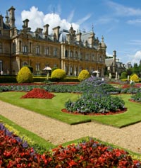 Waddesdon - Location of the famous Waddesdon Manor, this small, charming village is located to the north-west of Aylesbury in Buckinghamshire.
Stevenage - One of the Hertfordshire New Towns built in the 40's and 50's, Stevenage existed as a settlement and town long before this time, being inhabited back in Roman times and probably even before this. Located beside the A1 (M) it is now a busy commuter town with easy access into central London.
York - This fine historic walled city is one of Yorkshire's major tourist destinations. Walk the walls, visit York Minster or pop into one of the interesting museums, take your pick. York Map.
Chelmsford - The county town of Essex since earliest times, Chelmsford was also an important Roman town with a defensive fort. During the Second World War it was bombed due to its importance to industry. Today it is a bustling town with a population of over 100,000. Chelmsford Map
More Essex Maps: Brightlingsea - Harwich - Manningtree
Canterbury - A historic city which is one of England's primary tourist attractions, Canterbury has lots of historic structures to see and enjoy. Canterbury Map.
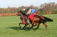 Newmarket - Headquarters of English horse racing, Newmarket has been holding horse races since the 12th century. James I built the first grandstand on Newmarket Heath and also held the first cup race. Newmarket Map.
Northampton: A large market town lying on the River Nene in the East Midlands, Northampton has a population of around 205,000 and a history going back to the Bronze Age, when it developed as a farming settlement. Northampton later became significant for its shoe industry.
Liverpool: The 3rd largest city in England and the 4th largest in the entire UK region, Liverpool is famous for its docks and its vibrant music scene, which produced such famous names as the Beatles, Gerry and the Pacemakers and the Searchers.
Scarborough: One of Yorkshire's most popular seaside resorts, Scarborough has maintained its popularity despite the general decline in the traditional English seaside resort. When the weather is pleasant the two beaches of Scarborough can still get pretty busy, and if the weather is inclement there are plenty of amusements and entertainment that can be enjoyed indoors.
Dorchester: Dorchester is a historic market town in Dorset, South West England, known for its Roman roots, charming Georgian architecture, and literary connections to Thomas Hardy, who set many of his novels in the surrounding countryside. Nestled on the banks of the River Frome, it offers a mix of heritage attractions, independent shops, and a relaxed pace of life. With its blend of old-world character and modern touches, it's a popular spot for visitors exploring the Jurassic Coast and rural Dorset.
Bridport - Bridport is a lively market town nestled in the heart of West Dorset, just a couple of miles from the dramatic Jurassic Coast. Known for its artsy, independent spirit and strong sense of community, the town blends history with creativity, thanks to its roots in rope-making and its thriving arts scene. With easy access to West Bay, scenic countryside walks, quirky shops, and regular markets, Bridport has a laid-back charm that draws both visitors and those looking to make it home.
Shaftesbury - Tucked away on a hilltop in the heart of rural Dorset, Shaftesbury is one of those places that seems to have quietly stepped out of another time. It's a small market town with bags of charm and character, best known for its cobbled streets, sweeping views over Blackmore Vale, and a certain iconic lane made famous by a bread advert back in the day—yes, that one, Gold Hill. With its mix of historic buildings, relaxed pace of life and a proper community feel, Shaftesbury isn't trying to be flash—it just gets on with being quietly beautiful.
Corfe Mullen - Corfe Mullen is a large village that sits just on the edge of the Dorset heathland, blending the feel of countryside living with the convenience of nearby towns. It's got a laid-back atmosphere, the kind of place where people know their neighbours and things move at a gentler pace. With a mix of older properties, family homes and green open spaces, it's popular with both long-time locals and those looking to escape the hustle without being completely cut off.
Blandford Forum - Blandford Forum is a tidy little market town nestled beside the River Stour in the heart of Dorset. It's known for its Georgian architecture, friendly vibe, and a proper sense of place. You don't get much in the way of big city fuss here—just a welcoming town with a good mix of shops, greenery, and that slower pace of life that seems to suit everyone who ends up staying.
Verwood - Verwood is a growing town tucked into the northeastern corner of Dorset, right on the edge of the New Forest. It’s one of those places that manages to keep a villagey feel despite its size, with plenty of green space, friendly faces, and a steady stream of families putting down roots. With a mix of older houses and newer developments, it’s become a bit of a go-to spot for those wanting countryside living without being in the middle of nowhere.
Lulworth Cove - The dorset tourist destination of Lulworth Cove is one of those places that really sticks in the mind - like a little pocket of paradise carved into the Dorset coast. It's a perfect horseshoe-shaped bay, tucked between steep cliffs and rolling green hills, where the sea laps gently onto white pebbles. The water's incredibly clear, the scenery's something out of a postcard, and it's no surprise it draws visitors all year round. Whether you're after a bit of exploring or just a quiet sit by the sea, it's a spot that does both beautifully.
West Bay Dorset - West Bay is a proper gem on Dorset's Jurassic Coast, known for its golden cliffs, shingle beaches, and that laid-back seaside feel that just hits right. It's a small harbour town that's managed to keep its charm, even with a steady stream of visitors rolling in. Whether you're in it for fish and chips by the sea, a walk along the clifftops, or just a good old paddle with the family, it's the kind of place where you can slow down and soak it all in.
Wareham Dorset - Wareham is a small market town with a big sense of history, sitting neatly between the River Frome and River Piddle, right at the gateway to the Isle of Purbeck. It's the sort of place where you can stroll along the old town walls, grab an ice cream by the quay, and still feel like you've stepped back in time. There's a real charm to it - quiet, friendly, and just the right mix of old and new.
Bournemouth Dorset - A lively seaside town on the south coast of Dorset, Bournemouth is known for its long sandy beaches, palm-lined promenades and laid-back holiday feel. It's the sort of place that has something for everyone - families on the beach, students filling the cafés, retirees enjoying the gardens, and surfers chasing the waves. With its mix of Victorian charm and modern buzz, Bournemouth blends tradition and energy in a way that keeps people coming back year after year.
Poole Dorset - Poole is a lively coastal town in Dorset, best known for its enormous natural harbour, long sandy beaches and mix of old-world charm and modern living. It’s the kind of place where you can hop on a boat one minute and be sitting at a waterfront café the next. With its working port, smart marinas, historic old town and family-friendly seafront, Poole brings together all the best bits of coastal life without trying too hard.
Christchurch Dorset - Christchurch is a charming riverside town tucked into the eastern edge of Dorset, where the rivers Avon and Stour meet before spilling out into Christchurch Harbour. It’s got that classic mix of seaside calm and old-town character, with plenty of cafés, cosy pubs, and independent shops dotted along narrow streets. There’s a relaxed pace here, whether you’re wandering along the quay or enjoying a cream tea with a view. It’s a bit of a hidden gem—close enough to bigger towns, yet with a personality all its own.
Ferndown Dorset - Ferndown is a leafy, well-kept town in East Dorset, sitting just north of Bournemouth and close to the border with Hampshire. It’s known for being peaceful and residential, with wide tree-lined streets, green spaces, and a slower pace of life that suits families and retirees alike. There's a strong sense of community, a tidy town centre, and easy access to both coast and countryside, which makes it a popular place to settle as well as a handy base for exploring the area.
Wimborne Minster Dorset - Wimborne Minster is a charming market town in East Dorset, known for its striking twin-towered church, relaxed pace and strong community feel. Sitting where the River Stour and River Allen meet, it’s the sort of place where history weaves neatly into everyday life. The centre’s full of character, with cobbled courtyards, tidy lanes, and a good mix of independent shops, cafés and old pubs that haven’t lost their soul. It’s got just the right balance of quaint and lively.
Farnborough Hampshire: Farnborough is a busy town in the northeast of Hampshire, known for its aviation heritage and well-connected location. It's the kind of place where business parks sit alongside historic landmarks, and there's always a low hum of activity. The town's got a practical feel to it, but there's also plenty of green space and just enough charm to make it a decent spot for both work and play.
Alton Hampshire: Alton is a historic market town nestled in the northeast corner of Hampshire, surrounded by rolling countryside and steeped in character. It's one of those places where you can still sense its medieval roots, with a traditional high street, old coaching inns, and a quiet charm that never feels too sleepy. It's well connected but far enough from the hustle to offer a proper breather.
More Hampshire Maps: Horndean - Winchester - Fareham - Waterlooville - New Milton
Penzance Cornwall: Penzance is a lively and characterful town sat right at the southwestern tip of Cornwall, where the land seems to gently lean into the Atlantic. It's got that salty sea air, palm trees lining the promenade, and a sense of laid-back charm that draws in everyone from surfers and walkers to artists and families. There's a real blend of old Cornish soul and modern creativity running through the streets, and you're never far from a cracking view of the coast.
Bodmin Cornwall: Bodmin is a traditional Cornish town with a slightly rugged charm, sitting right on the edge of Bodmin Moor. It's got that proper “old market town” feel—stone buildings, narrow lanes, and the sort of high street where locals still pop in for bits and bobs rather than just rushing about. There's a sense of heritage here that you can't fake, and although it's not flashy, Bodmin has a solid heart and a community that keeps things ticking along.
Portishead Somerset: Portishead is a lively coastal town perched on the Severn Estuary in Somerset, offering a mix of marina life, green open spaces and a strong sense of community. Once a quiet fishing village, it's grown into a popular spot for families and commuters alike, with sea views on one side and rolling countryside on the other. The town centre has plenty to offer, and the scenic Lake Grounds are a favourite place to stroll, picnic or just sit and watch the world go by - Portishead Map
More Somerset Places: Bath - Frome - Keynsham
Broadstairs Kent: Broadstairs is a charming seaside town on the Isle of Thanet, nestled between Margate and Ramsgate along the Kent coast. It's got that old-school British seaside feel but with a touch of modern creativity thrown in. With its sandy bays, chalky cliffs and a lively little town centre full of independent spots, it draws families, holidaymakers and day-trippers looking for a laid-back escape by the sea - Broadstairs Map
More Kent Places: Dover - Allhallows-on-Sea
Other Countries
St Lucia - St Lucia is a popular holiday island, located in the Windward Islands, in the Caribbean Sea. St Lucia Map.
Italy - Southern European country bordering France, Austria, Switzerland and Slovenia, Italy is a popular tourist destination. Italy Map.
Spain
Alicante - A compact city and port in Spain, Alicante is overlooked by the Moorish, Santa Barbara Castle. Alicante Map.
Torrevieja - Surrounded by 2 huge salt lagoons, Torrevieja has been important for the production of salt since Roman times. Torrevieja Map.
Benalmadena - A popular beach resort on the Costa del Sol, Benalmadena is sandwiched between Torremolinos and Fuengirola. Benalmadena Map.
Costa Blanca - Orihuela Costa - Playa Flamenca
USA (USA Map)
Florida - A state in the south-eastern region of the USA, Florida has a population of around 18 million. Florida Map.
Clearwater - A city of 108,000 people, Clearwater is situated in the Tampa Bay Area, in Pinellas County, Florida fl. Clearwater Map.
Mexico
Cabo San Lucas - A popular holiday destination and sport fishing centre, Cabo San Lucas has plenty of high class holiday developments to choose from. Cabo San Lucas Map.
Trades and Tradespeople
Man With a Van, Video Production, Concrete Driveways, Fencing Contractors, Soffits & Fascias, Spanish Lessons, Scaffolders, Dog Grooming, Garage Conversion, Loft Conversion, Damp Proofing, Resin Driveways, Shed Builders, Hedge Cutting, Grass Cutting, Patio Layers, French Lessons, Driveways, Bathroom Fitters, Block Paving, Patio Builders, Asbestos Removal, Mortgage Advice, Financial Advisers, Gutter Cleaning, Web Design, Will Writing, Accountants, Tree Surgeons, Landscapers, Roof Cleaning, Science Tuition, Payroll Services, Gutter Repairs, Spanish Lessons, Skip Hire, Gardeners, English Lessons, Wedding Cakes, Maths Tutoring, House Clearance, Cleaners, Plumbers, Handyman, Solar Panels, Home Insulation, Roof Repair, Artificial Grass, Garden Clearance, Flat Pack Assembly, Bedroom Fitters, Cat Flap Fitters, Doors, Driveway Cleaning, Drone Photography, Gutter Replacement, Pressure Washing, Wallpapering, Asbestos Management, Decking Fitters, Gate Fitters, Air-Con, Tree Surgery
Counties: Bedfordshire - Berkshire - Buckinghamshire - Cambridgeshire - Cheshire - Cornwall - County Durham - Cumbria - Derbyshire - Devon - Dorset - East Sussex - East Yorkshire - Essex - Gloucestershire - Greater Manchester - Hampshire - Herefordshire - Hertfordshire - Isle of Wight - Kent - Lancashire - Leicestershire - Lincolnshire - London - Merseyside - Norfolk - Northamptonshire - Northern Ireland - North Yorkshire - Northumberland - Nottinghamshire - Oxfordshire - Scotland - Shropshire - Somerset - South Yorkshire - Staffordshire - Suffolk - Surrey - Tyne and Wear - Wales - Warwickshire - West Midlands - West Sussex - West Yorkshire - Wiltshire - Worcestershire - Yorkshire